Quick Facts
- Distance: 24.6 miles from Mattole to Black Sands.
- Duration: 3-4 days.
- Best Time: May to September (Peak Season).
- Access: High-demand wilderness permits required.
- Terrain: Soft sand, boulder fields, and intertidal zones.
- Safety: Mandatory tide literacy and bear canisters.
To backpack the lost coast trail, you must obtain a wilderness permit through the Bureau of Land Management via Recreation.gov. Permits are required year-round for overnight use and are typically released 90 days in advance. Due to high demand and limited daily entries, early planning is essential, and hikers are also required to carry bear canisters and valid California campfire permits for stove use.
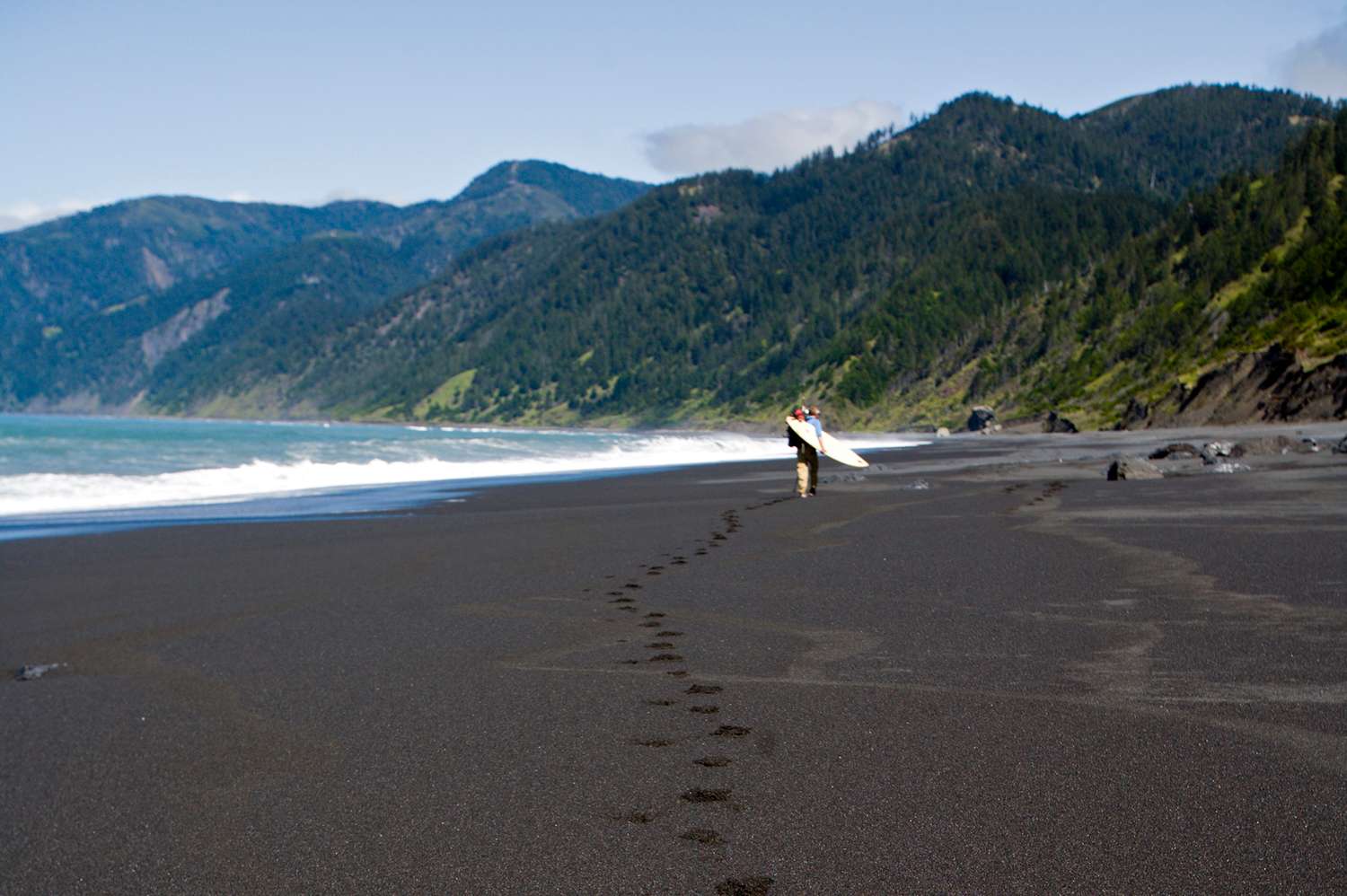
Backpacking the lost coast trail is a ritual of passage for those seeking true Northern California wilderness. Unlike any other coastal hike, this trail is defined by the rhythm of the Pacific. I’ve trekked across the globe, from the high Andes to the dense jungles of Southeast Asia, but there is something uniquely humbling about a place where the road simply gives up. In the King Range National Conservation Area, the mountains meet the sea with such violence that engineers couldn’t build a highway here, leaving us with a raw, untouched coastline that demands respect and meticulous planning.
Logistics for the 25-mile trek usually involve hiking north to south from Mattole Beach to Black Sands Beach. Since the route is point-to-point through remote wilderness, hikers typically book a commercial shuttle to transport them between the trailheads. Shuttles generally run during the peak season from March through October, and bookings should be secured well in advance of your permit date. This isn't just a walk on the beach; it’s a tactical operation against the elements.
Surviving the Tides: Your Window of Opportunity
Safety on the lost coast trail is dictated by the Pacific tides, as several sections become completely impassable and dangerous during high tide. I cannot emphasize this enough: the ocean is the boss here. If you miscalculate your window, you risk being pinned against sheer cliffs by rising swells. Hikers must navigate three major tide-restricted zones, including two stretches measuring 4 miles and 4.5 miles, which become impassable when tide levels exceed roughly 2.5 to 3 feet.
Before you even lace up your boots, you must print out current tide tables for Shelter Cove and carry them in a waterproof sleeve. I recommend checking these tables multiple times a day. You aren't just looking for "low tide"; you are looking for the receding tide. It is recommended to travel at a pace of roughly one mile per hour through boulder fields to ensure safe passage before the tide returns. The terrain is exhausting—imagine walking on thousands of slippery bowling balls while a heavy pack tries to throw you off balance.
| Impassable Zone | Location | Approximate Length | Threshold |
|---|---|---|---|
| Zone 1 | Punta Gorda to Sea Lion Gulch | 2.0 Miles | 3.0 ft |
| Zone 2 | Sea Lion Gulch to Randall Creek | 4.0 Miles | 2.5 ft |
| Zone 3 | Miller Flat to Gitchell Creek | 4.5 Miles | 2.5 ft |
When you enter these lost coast trail impassable zones, your focus should be absolute. Watch the horizon for rogue waves and keep an eye on the "pinch points" where the cliffs meet the water. If the tide is coming in and the water is hitting the base of the cliffs, stop and wait. There is no prize for getting swept out to sea. This dance with the tide window is what makes this trail so exhilarating, but it’s also what makes it dangerous for the unprepared.
Locking in the Logistics: Permits and Shuttles
Getting onto the trail is often harder than the hike itself. The Bureau of Land Management limits overnight entry to the King Range Wilderness to 30 people per day from September 16 to May 14, increasing the quota to 60 people per day during the peak season from May 15 to September 15. Because this is one of the most sought-after lost coast trail permit options in the country, you need to be at your computer the moment they are released on Recreation.gov.
The logistical puzzle continues with the lost coast trail shuttle. Because the trail is linear and remote, you’ll likely leave your car at Black Sands Beach in Shelter Cove and take a shuttle up to Mattole Beach to begin hiking north to south. Don’t let the short distance on a map fool you; while the trail is about 25 miles, the road connecting the ends is a two-hour white-knuckle drive over steep, winding mountain ridges. Booking your lost coast trail shuttle logistics early is non-negotiable, as these vans fill up months in advance.
I always recommend the north-to-south direction because of the prevailing winds. If you hike south to north, you’ll be fighting a relentless headwind that sandblasts your face and makes every mile feel like three. By starting at Mattole Beach, you keep the wind at your back, pushing you toward the finish line at Black Sands Beach.
The Rugged Kit: Specialized Gear for the Coast
Your standard mountain gear won't always cut it here. When planning your backpacking gear for lost coast trail, you need to account for the unique environment. I prefer breathable trail runners with gaiters over heavy waterproof boots. Why? Because you will inevitably get wet during creek crossings, and sand will find its way into everything. Heavy boots take forever to dry and act like anchors when they’re full of wet sand.
The lost coast trail weather is notoriously fickle. This region can receive upwards of 100 inches of rain annually, and fog can roll in so thick you lose sight of the person ten feet ahead of you. A solid, lightweight rain shell is a must, even in July.
Expert Tip: Hard-sided bear canisters are mandatory for all overnight stays. The local black bears are smart and habituated to hikers. If you don't own one, you can often rent them locally in Shelter Cove for a small fee, but it’s better to bring your own so you know how to pack it correctly.
Don't forget the Punta Gorda Lighthouse as a navigational landmark. It’s a great spot to take a break, but it’s also a reminder of how treacherous these waters are. While the lighthouse is no longer active, it stands as a sentinel over a coastline that has claimed many ships. When packing, ensure your electronics are in dry bags and you have a reliable way to filter water from the various creeks that descend from the King Range.
Leave No Trace: The Swash Zone Rule
In most wilderness areas, you bury your waste 6-8 inches deep in a "cathole" away from water. The Lost Coast is different. Because the soil is mostly sand and the bluffs are fragile, the BLM requires the "swash zone" method for human waste. This means you find a spot between the low and high tide lines—the area where the waves wash over the sand—dig your hole, and let the incoming tide naturally carry the waste out to sea. It feels counterintuitive at first, but it is the most ecologically sound way to handle waste in this specific Northern California wilderness.
Keep your eyes peeled for wildlife, but keep your distance. You are almost guaranteed to see Roosevelt elk grazing on the coastal bluffs or lounging in the tall grass near the creeks. They are massive, majestic, and can be aggressive if you get too close. Similarly, the beach is home to large colonies of sea lions and elephant seals. They may look like lazy sausages on the sand, but they move surprisingly fast and have a nasty bite. Give them a wide berth, especially during pup season.
The northern section of the lost coast trail covers approximately 24.6 miles between Mattole Beach and Black Sands Beach and typically requires three to four days to complete due to challenging terrain. I recommend a four-day lost coast trail itinerary to allow for tide delays and to actually enjoy the scenery. Rushing through this landscape is a mistake; the sunsets over the Pacific are some of the most spectacular you will ever witness.
FAQ
How long does it take to hike the Lost Coast trail?
Most hikers complete the 24.6-mile northern section in three to four days. The pace is significantly slower than inland trails due to the soft sand, slippery boulders, and the necessity of waiting for low-tide windows to pass through restricted zones.
Is the Lost Coast trail worth it?
Absolutely. It offers one of the few places in the lower 48 states where you can experience a completely wild, undeveloped coastline. The combination of rugged mountains, marine wildlife, and the rhythm of the ocean provides a sense of solitude that is hard to find elsewhere.
Do you need permits to hike the lost coast?
Yes, a wilderness permit from the Bureau of Land Management is required year-round for all overnight stays in the King Range Wilderness. These must be reserved in advance via Recreation.gov and are subject to daily quotas.
Is the Lost Coast trail safe?
The trail is safe for those who are prepared, but it can be extremely dangerous for the uninformed. The primary risks are getting trapped by the tide in impassable zones, rogue waves, and unpredictable weather. Proper tide literacy and physical fitness are essential for a safe trip.
Is there cell service on the Lost Coast trail?
Cell service is almost non-existent for the entirety of the trek. The remote nature of the King Range blocks signals, so you should not rely on your phone for navigation or emergencies. Carrying a satellite messenger like a Garmin inReach is highly recommended for safety.